Property Record
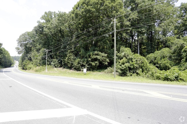
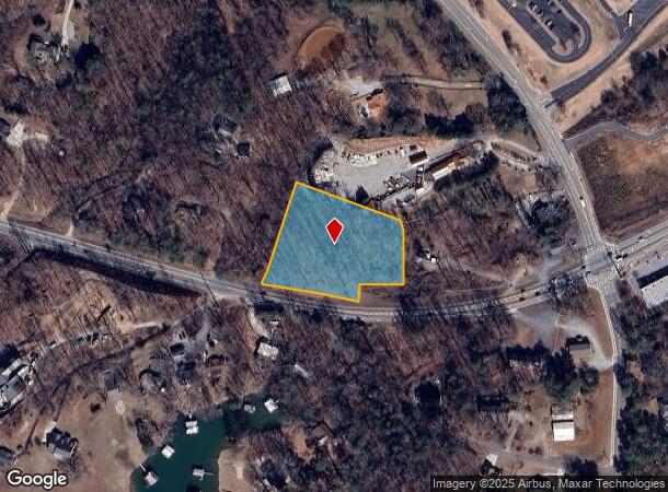
Browns Bridge Rd, Gainesville, GA 30506

NEARBY LISTINGS FOR SALE OR LEASE
Property Detail
Browns Bridge Rd
Atlanta-Sandy Springs-Roswell, GA
Brown Bridge East Comm
283-114
14-1 799-800
Commercialnec
Forsyth
X
Georgia
13139C0275G
799
2024
2.02 AC
2025
N Fulton/Forsyth County
000307
Atlanta
DEMOGRAPHICS near Browns Bridge Rd
1 Mile
3 Mile
5 Mile
2024 Total Population
2,135
14,271
37,401
2029 Population
2,497
16,709
43,650
Pop Growth 2024-2029
+ 16.96%
+ 17.08%
+ 16.71%
Average Age
42
43
41
2024 Total Households
761
5,130
13,477
HH Growth 2024-2029
+ 17.08%
+ 17.12%
+ 16.76%
Median Household Inc
$98,386
$99,578
$96,894
Avg Household Size
2.80
2.80
2.70
2024 Avg HH Vehicles
2.00
2.00
2.00
Median Home Value
$523,089
$498,648
$416,547
Median Year Built
1997
1995
1998
Nearby Places
Map Layers
Map Styles
 Street
 Aerial
- Restaurants
- Banks
- Shops
- Fitness
- Groceries
SALE & LEASE HISTORY
LISTING DATE
SALE/LEASE

May 30, 2019
For Sale
Nearby Properties
Address
Land Use
TOTAL SIZE
Lot Size
Zoning
Address
Land Use
TOTAL SIZE
Lot Size
Zoning
250,371 SF
88.47 AC
A1
Address
Land Use
TOTAL SIZE
Lot Size
Zoning
74,796 SF
9.92 AC
CBD
Address
Land Use
TOTAL SIZE
Lot Size
Zoning
181,442 SF
32.34 AC
A1
Address
Land Use
TOTAL SIZE
Lot Size
Zoning
80,956 SF
6.07 AC
CBD
Address
Land Use
TOTAL SIZE
Lot Size
Zoning
375 SF
154 AC
LR
Address
Land Use
TOTAL SIZE
Lot Size
Zoning
4,450 SF
106 AC
LR
Address
Land Use
TOTAL SIZE
Lot Size
Zoning
13.25 AC
CBD
Address
Land Use
TOTAL SIZE
Lot Size
Zoning
33,608 SF
3.34 AC
HB
Address
Land Use
TOTAL SIZE
Lot Size
Zoning
3,060 SF
8.47 AC
M1
Address
Land Use
TOTAL SIZE
Lot Size
Zoning
1,595 SF
16.76 AC
CBD
Address
Land Use
TOTAL SIZE
Lot Size
Zoning
47,453 SF
6.87 AC
CBD
Address
Land Use
TOTAL SIZE
Lot Size
Zoning
46,540 SF
11.10 AC
CBD
Address
Land Use
TOTAL SIZE
Lot Size
Zoning
33,376 SF
4.34 AC
M1
Address
Land Use
TOTAL SIZE
Lot Size
Zoning
4.85 AC
M1
Address
Land Use
TOTAL SIZE
Lot Size
Zoning
5,810 SF
13.34 AC
CBD
Address
Land Use
TOTAL SIZE
Lot Size
Zoning
25,412 SF
2.65 AC
CBD
Address
Land Use
TOTAL SIZE
Lot Size
Zoning
6.91 AC
A1
Address
Land Use
TOTAL SIZE
Lot Size
Zoning
22,280 SF
1.94 AC
M1
Address
Land Use
TOTAL SIZE
Lot Size
Zoning
20,040 SF
2.17 AC
M1
Address
Land Use
TOTAL SIZE
Lot Size
Zoning
1,922 SF
21 AC
CBD
Address
Land Use
TOTAL SIZE
Lot Size
Zoning
1,564 SF
20.37 AC
CBD
Address
Land Use
TOTAL SIZE
Lot Size
Zoning
28,812 SF
6.84 AC
CBD
Address
Land Use
TOTAL SIZE
Lot Size
Zoning
20,205 SF
1.33 AC
M1
Address
Land Use
TOTAL SIZE
Lot Size
Zoning
22,000 SF
6 AC
M1
Address
Land Use
TOTAL SIZE
Lot Size
Zoning
20,000 SF
2.07 AC
M1
Address
Land Use
TOTAL SIZE
Lot Size
Zoning
1,758 SF
48.35 AC
A1
Address
Land Use
TOTAL SIZE
Lot Size
Zoning
20,000 SF
1.92 AC
M1
Address
Land Use
TOTAL SIZE
Lot Size
Zoning
15,846 SF
1.48 AC
CBD
Address
Land Use
TOTAL SIZE
Lot Size
Zoning
3,090 SF
48.76 AC
A1
Address
Land Use
TOTAL SIZE
Lot Size
Zoning
43,528 SF
5.08 AC
CBD
The World's #1 Commercial Real Estate Marketplace
Connect with us
© 2025 CoStar Group
The information above has been obtained from sources believed reliable. While we do not doubt its accuracy we have not verified it and make no guarantee, warranty or representation about it. It is your responsibility to independently confirm its accuracy and completeness. Any projections, opinions, assumptions, or estimates used are for example only and do not represent the current or future performance of the property. The value of this transaction to you depends on tax and other factors which should be evaluated by your tax, financial, and legal advisors. You and your advisors should conduct a careful, independent investigation of the property to determine to your satisfaction the suitability of the property for your needs.